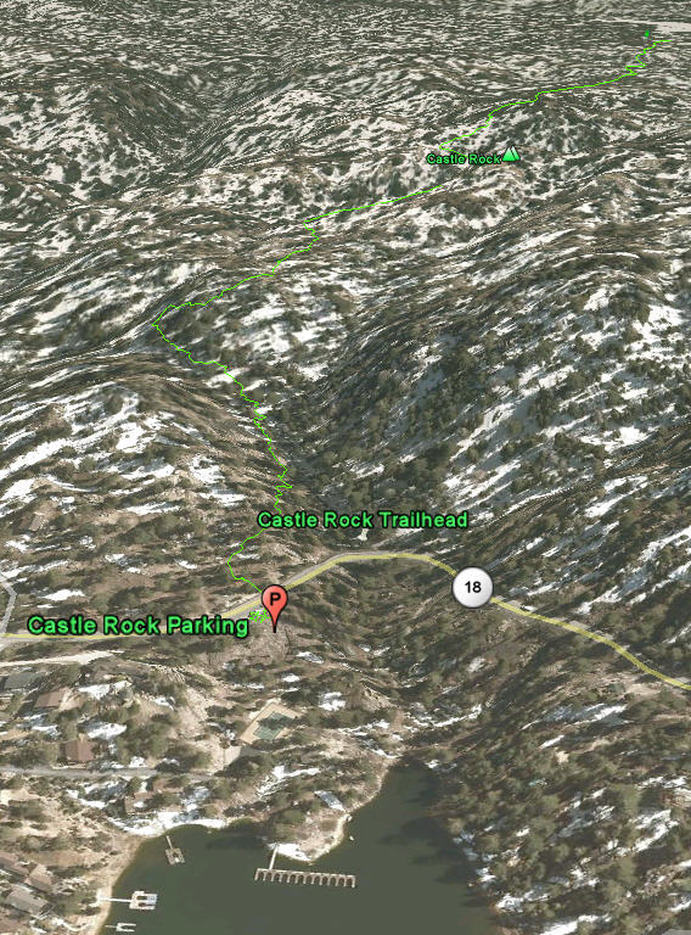
Castle Rock Trail - Big Bear Lake, CA ( GPS MAP Pictures )
Elevation Start 6890ft, End 7326ft
Distance: Just less than a mile from 18 Trailhead to Castle Rock
This is a great trail for everyone. The payoff is incredible views of
the lake and valley. This trail is quite steep, but since its only a
mile, almost everyone can do it with a few breaks to gasp for more of our thin mountain air. My GPS
route below goes from trail head to trail head with Castle Rock in the middle.
This trail should not be attempted when there is snow on the ground
without crampons or snowshoes as sections are steep, slippery and
treacherous.
Download .KMZ file to Google Earth or your GPS device below!
Guide by Grayson - www.BigBearHostel.com
Download .KMZ file to Google Earth or your GPS device below!
Guide by Grayson - www.BigBearHostel.com
Castle Rock Trail as seen in Google Earth
NOTE - you can hike to it from North or South.
| castle_rock_trail.kmz |