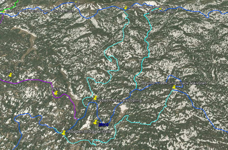
Stonehenge Trail - Big Bear Lake, CA ( GPS MAP Pictures )
Elevation: Top 7740ft, Bottom 7270ft - 500ft descent
Distance: 1.4 miles!
Very fun Singletrack descent. I would recommend going up Plantation and down Stonehenge. Up would not be fun.
Guide by Grayson - www.BigBearHostel.com
Guide by Grayson - www.BigBearHostel.com
Pine Knot Trail as seen in Google Earth
Download bigger version of this 3d image.
| plantation_trail__2n52y.kmz |
Download .KMZ file to Google Earth or your GPS device below!
| stonehenge_singletrack.kmz |
Stonehenge Trail Video
Coming Soon....