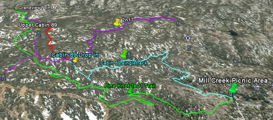
Upper Cabin 89 Trail - Big Bear Lake, CA ( GPS MAP Pictures )
Elevation Start 7640ft, End 7480ft
Distance: 0.9 miles
Here is a little bit more singletrack to explore above Cabin 89 drop in on 2n17. Its got some steep spots but it has some nice flowing singletrack as well. I would ride it from South to North if you are bored with Pine Knot Trail.
Guide by Grayson - www.BigBearHostel.com
Guide by Grayson - www.BigBearHostel.com
Upper Cabin 89 as seen in Google Earth.
Download .KMZ file to Google Earth or your GPS device below!
| upper_cabin_89_trail.kmz |