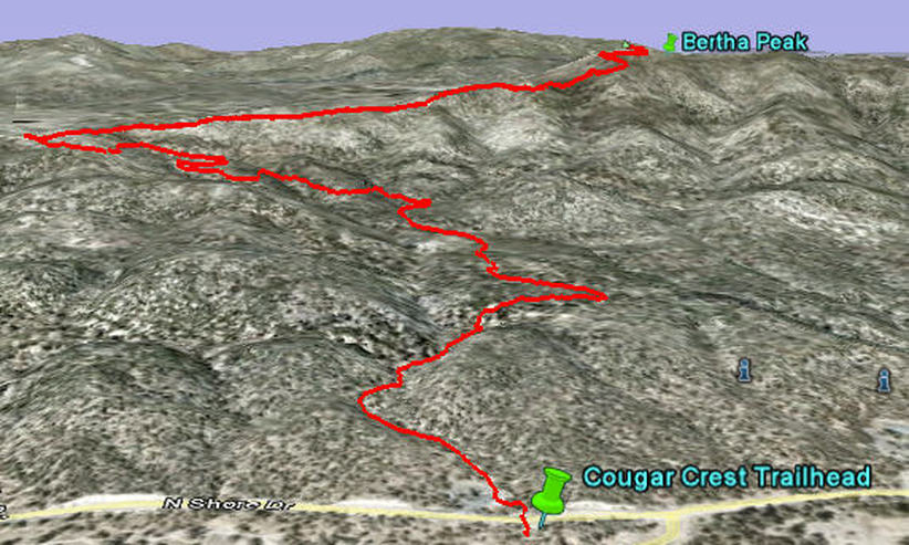
Berth Peak Trail via Cougar Crest - Big Bear Lake, CA
Elevation: Start 6696ft - End 8120ft
Distance: 3.8 miles each way
Out and back
Cougar Crest Trail is about 2.4 miles up and you can't get lost. There is a well marked parking lot at the trail head.
The trail winds up and at mile 2.2 you will have incredible views of the whole valley and lake.
The trail keeps going over and behind the ridge and turns into a road that goes up to Bertha Peak.
The valley to the North is Holcomb Valley. There is lots of Gold Mining History in Holcomb Valley and you can drive through it on the Gold Fever Trail (a self guided driving tour)
You can see Bertha Peak from various spots along Cougar Crest Trail. (Its the peak to the NE with the radio towers on it)
This trail provided by Grayson @ BigBearHostel.com
3D view Cougar Crest and Bertha Peak Trails from Google Earth
| bertha_peak_hike.kmz |